熱門標籤
Academic Research
Education and Training
Motorcade Transportation repairs
Accompany reading
Home Care
Wildlife And Nature Tree Planting
Central America Medical Action
africa Medical Action
Asia Medical Action
Fieldwork
Emergency Relief
Story List
Donate Materials
Medias
NGO NPO
Introduction Volunteering
Domestic Medical Missions
Visitors:204
Page Viewed:14257863
Page Viewed:14257863


Page:Home > News
News
2016 China Qinghai Mission Report
Taiwan Root 08/2016 China Qinghai Missin Report:
Written by Doctor Shen, Li Xiang and his son Li Yao
1. Geography
Yushu - Airport - Nangchen - Camp Site - Dule Temple - Gah Temple
Yushu City - Airport 12km
Airport - Nangchen County 149km
Nangchen County - Camp Site 30km
Camp site - Dule Temple 9km
Dule Temple - Gah Temple 5km
Travel time from the airport to the Dule Temple is roughly 4~5 hours. The airport is connected to Nangchan County by the highway, which crosses 3 mountains that are each at least 4000 meters high (highest 4493m). The drive is similar to the drive from Nantou to Mount Hehuan. Nangchan County and the two temple are connected by gravel roads similar to Taiwan's mountain industrial roads; the ride is not very pleasant.
Altitude and Atmospheric Pressure
Airport and Yushu City 3771m 0.686 atm
Nangchan County 3560m 0.654 atm
Campsite 3693m 0.642 atm
Dule Temple 3943m 0.620 atm
Gah Temple 4139m 0.602 atm
2.Highland Reaction Levels:
Not as severe as predicted. On the first day upon landing in Qinghai, there were no signs of discomfort, except for some elders who had headaches in the evenings. Ibuprofen were prescribed and no symptoms were visible the next day. (For prevention usages: Diamox 1# tid in 24hrs )
Blood Oxygen、Heart Rate Record
Elderly Youth
Airport O2% 84 88
3771m HR. 113 92
Campsite 90 95
3693m. 95 80
Dule Temple 80 84
3943m. 120 95
(Randomized sampling and comparison with native residents showed no abnormal results)
3. Recommend Personal Items:
(Randomized sampling and comparison with native residents showed no abnormal results)
3. Recommend Personal Items:
Reusable usuable bowls and chopsticks (prevent additional pollution and burden on the temple). Rain gear in light of occasional rain.
4. Local Sanitation Conditions:
Poor local sanitation conditions. Please bring personal tissues, wet wipes (Dule temple currently has squat toilets and showers). Please bring disposable clothings and socks due to the inconvience of washing clothes.
5. Local Weather: The temperature difference between the day and night is large: temperature is about 20-30 degrees during the day and 2 degrees during the night. A warm jacket is necessary at night. The temple will provide blankets and mattresses, but they aren't very clean. Sleeping bags are optional and depends on personal preferences.
6. Number of Patient:
The number of patients could not be accurately assessed. Nangchen County has a population size of 20,000 people. Our host, the Rinpoche, said that with local residents, religious people, family and people coming from neighboring Tibet, it is highly likely to treat the number of patients we had predicted to meet.
7. Clinic Sites:
a. Dule Temple
According to the Rinpoche, by the end of August, a new conference room will be constructed including bedrooms and bathrooms (currently under construction).
b. Campsite (using tents)
( Too spacious, poor sanitation, unstable electric power source, tents are not heavy rainproof)
c. Gah Temple's clinic
( higher altitude, harder to breathe )
d. Regardless to where the clinic is set up, Dule temple will be the first choice for lodging with the campsite being the second choice.
8. Travel Advice:
8. Travel Advice:
Since the airport and Yushu City's altitudes are roughly the same, the probability of having altitude sickness is low. It is more likely to feel discomfort from the drive around the mountain roads. We advise travelers to drive directly to the lodging to rest to save time. Phone reception is poor, even with China's travel agency's phone.
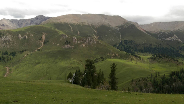
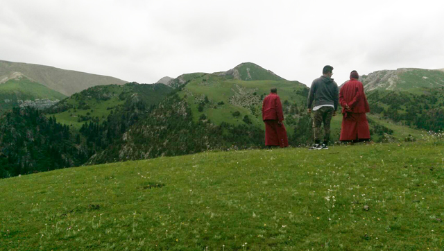
The mountain range facing the Dule Temple
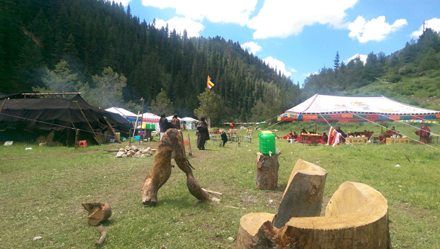
Dharma assembly at the campsit
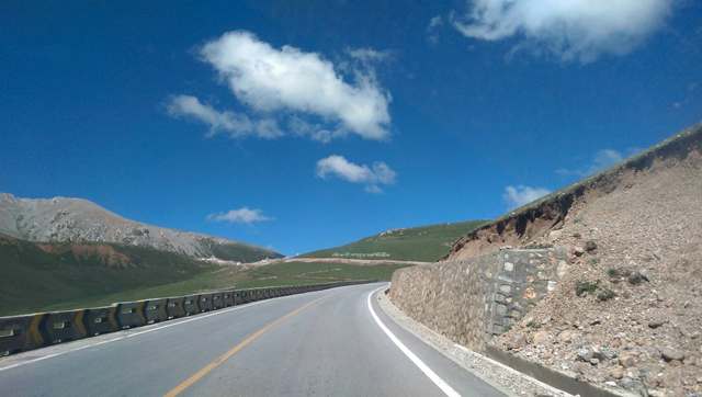
Mountain road from the airport to Nangchan County
Mountain road from the airport to Nangchan County
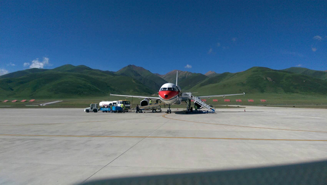
Batang Airport
Sky burial site on the mountain tops
Sky burial site on the mountain tops
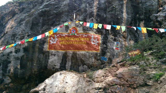
Prayer branners can be seen all across the mountainside